Anemone Cave in Acadia National Park
To begin with, all the older maps of Acadia National Park all have the words ANEMONE CAVE written on them in bold letters, not so on the more modern maps, and all maps put out by the National Park Service no longer contain any mention of the famous sea cave. The reason why is the National Park service has decided to abandon the sea cave, much like it has done in the past with many of the once popular hiking trails.
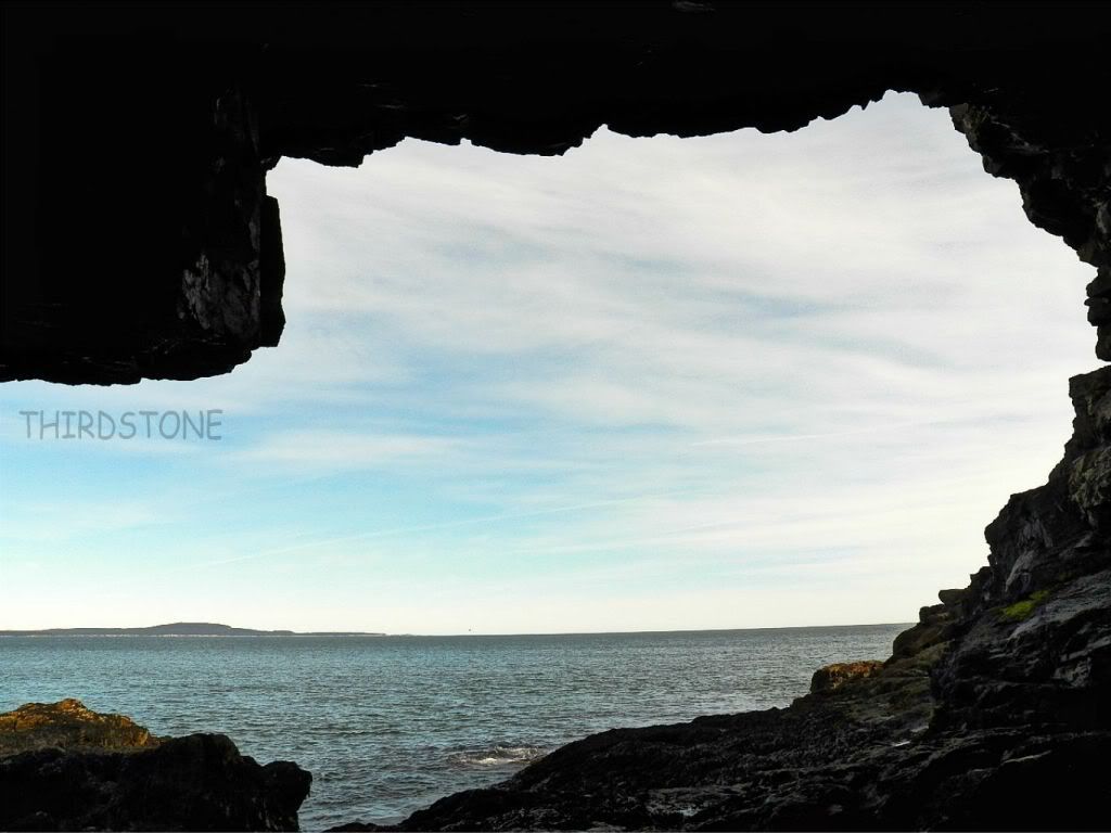
This is a view taken from inside the sea cave looking out toward sea. At high tide, the entire cave goes under water. Years ago you could drive to Schooner Head Overlook, park your car and walk to the cliffs, where a sign for the cave once was, along with a railed walkway down the cliffs to the cave itself. The rail fence and sign were removed years ago, and more recently the cave itself no longer shows up on park maps.
There are two ways to reach the parking lot at Schooner Head Overlook. One way is to head out of downtown Bar Harbor, along route 3 as if heading toward the town of Otter Creek. Just past the town ball field, at the top of the hill on the left hand side is the Schooner Head Road, which takes you to Schooner Head Overlook. You will come to a four way intersection, turn left, the parking lot is just ahead.
The second way to reach the Schooner Head Overlook is by driving along the One Way Section of the Park Loop Road. Once the entrance Fee station comes into view, look for a narrow road to the left, just before the fee station. This is a connector road to Schooner Head Road. Turn onto it, and a very short distance you come to the four way intersection, go straight ahead, the parking lot will be just ahead.
The sign in the parking lot that once talked about the cave has now been replaced with a sign talking about the park. The paved path leading to the cliffs is still there, follow it until you come to the cliffs. When the path reaches the cliffs, you will actually be standing right over the cave. Most people today still access the cave from the right hand side, and I have seen many attempt to make the climb down to the cave from that side, but without the rail fence, the rocks are slippery and just yesterday alone we saw a couple people nearly fall off the cliff trying to climb down it.
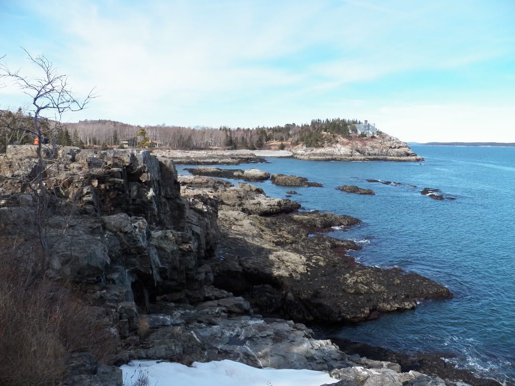
(view of cave below, taken from right hand approach)
Now the approach to the cave was from the right, as your looking out toward sea, but the easier approach, and much safer, is from the left. Follow the path along the top of the cliff, moving to the left, before long you will see a long crevice or downward gully leading at an angle toward the direction of the cave. Follow this and it will lead you right to the cave entrance. As you near the cave and can see into it, the rocks become slippery, and wet seaweed is everywhere. The inside of the cave is wet with tidal pools, and the footing inside the cave is very slippery. Poor footing was most likely the main reason for the park service to abandon the cave and remove it from more recent maps. Just remember, at high tide you will not be able to see any cave at all.
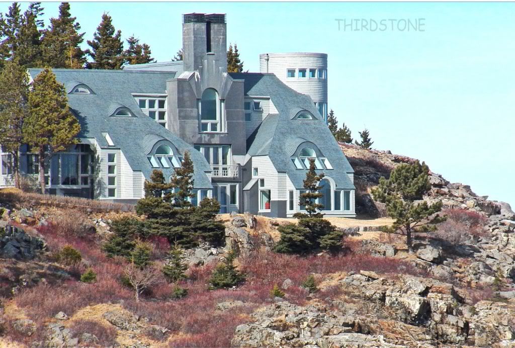
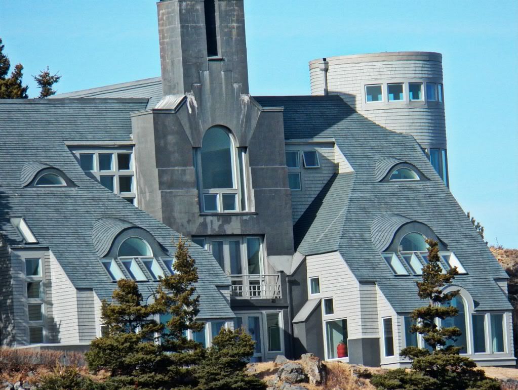
Something worth noteing, see the photo above, out on that point is a very rich estate. Locals refer to it as The Castle, below is a close up photo of it.